Researching the Indigenous place names of the Saanich Inlet (“researching” here glossed as “typing into a search box”), one hits a frustrating wall immediately after finding a promising source named wat_wq_saanich_sisrofnc.pdf, the June 1995 Saanich Inlet Study Report on First Nations Consultation.
Opening the PDF (links: BC Legislature; MLA SȾHENEP Adam Olsen) swirls you into an Internet eddy: 64 pages of e-stalgia, a snapshot of a nineties government website in Times New Roman with blocky GIF headers. In the table of contents, there’s a working blue link to Appendix B with the keywords you searched, wow!
But, crestfallen: (This Appendix is available in the printed copy of this report only). Naturally, it’s the only part of the SISROFNC that didn’t make the printed-website version. After page 4, there are 40 pages of nearly incomprehensible archaeological information, chunked into BLOCK TEXTU AHELL NUGGS—then on p.45, more of the report’s thoughtfully written prose.
British Columbia’s Environment Ministry conducted a series of studies on the Saanich Inlet in the mid-1990s, under the auspices of its Water Quality Branch. Between 1995 and 1996, the sub-components of the study were published in print for limited distribution. Evidently (given design), they were put online in roughly that era; as stamped in the PDF, that site stayed there until at least 2007.
For anyone curious to read an accessibly-written technical report about the Saanich Inlet from a variety of lenses, the 1996 Saanich Inlet Study Synthesis Report is available as a PDF scan of the printed edition via the BC government. Simonsen is credited as primary author there as well. Glass sponges abound!
S2-1995 is the reason Factso is here today. On December 15, 2023, I visited the UVic Library, having discovered that the nearest print copy of SISROFNC awaited me on the shelves there. Waiting to get my hands on it from the librarian I’d emailed, I went down another rabbit hole at the Law Library and gasped, picking up a signed 1984 first edition of Salt Water People by PENÁĆ Dave Elliott Sr.
Factso is excited to share this highly detailed, thoughtfully composed summary of Indigenous context from around the Saanich Inlet. Elders’ insights, memories, stories, and hand-written phonetic approximations of place names provide a wide survey of the Inlet and its peoples. In the spirit of CTA79, Factso transcribed, sorted, and re-structured previously inaccessible context about the contributions of Indigenous peoples to Canada’s history.
Inside: What this SO-RCD 💾 doc tells us
Despite the challenging structure of the remnant SISROFNC PDF, the deeply-researched contents of the sprawling table-chunks retain value, as does the prose summarizing the work. It speaks volumes that something so poorly formatted has clung to its digital existence all these years, even without this part.
Appendix B is the culmination of decades of relationship-building with First Nations. Interviews were conducted with 30 Indigenous knowledge keepers, including on a boat tour of the marine resources and heritage.
Secondary sources covering Inlet-area Indigenous toponyms were also drawn from extensively. Fuller citations below for reference:
Factso has added links to Montler’s numbered place names list (via saanich.montler.net), with 🔊 emoji added highlighting names you can hear.
Rozen, David Lewis. Place-Names of the Island Halkomelem Indian People. 1985 (MA thesis, UBC).
UBC makes theses available for educational purposes: Rozen, 1985 (PDF link)
The bulk of Simonsen’s secondhand sourcing comes via Rozen; Rozen’s thesis is occasionally quoted at length in Appendix B.
Jenness, Diamond. The Saanich Indians of Vancouver Island. 1934-1938, unpub. manuscript.
A handful of mimeographed copies of this manuscript exist today, including one also at the UVic Library, scanned to appear in a future SO-RCD.
Contemporary anthropologist Barnett Richling edited Jenness and published the text with additional field note gleanings in a 2017 edition.
Hudson, Douglas. Some Geographic Terms of the Saanich Indians of Southern Vancouver Island, BC. UVic, 1970-1971, unpub.
Barnett, Homer. The Coast Salish of British Columbia. Univ. of Oregon, 1955.
While accessing the printed copy, Factso compared the PDF printout against the original and confirmed the accuracy of the transcript. In addition to Appendix B, Factso has scans of maps and tables, and intends to re-compile them with the prose from the PDF as future SO-RCD and ATLAS items.
Note that typographical errors are reproduced in the transcripts. Some of the ways Simonsen has written SENĆOŦEN terms do not exactly agree with the source he cites. Likewise, some written phonetics were challenging to render correctly by Factso, and so as presented may not meet a linguist’s exacting standards. For a reference point on these discrepancies, compare vs. S1-1984.
S2-1995 is presented below on a page-accurate basis, with some exceptions where entries cross pages. Approximate spelling and grammatical markings (diacritics/accents) for the SENĆOŦEN and phonetic terms were manually transcribed into turquoise SENĆOŦEN, yellow IPA, and white sounds-like-spellings. Chronological references to historical events and years in magenta.
Contents: Navigate this SO-RCD 💾 doc
Scans:Saanich Inlet Study, Report on First Nations Consultation, front matter (4 pages), Appendix B (17 pages)
Transcripts follow. Images link to texts; texts link to images.
Transcripts: Place Names Attributed to Cultural Resource Sites of the Saanich, Malahat, and Cowichan
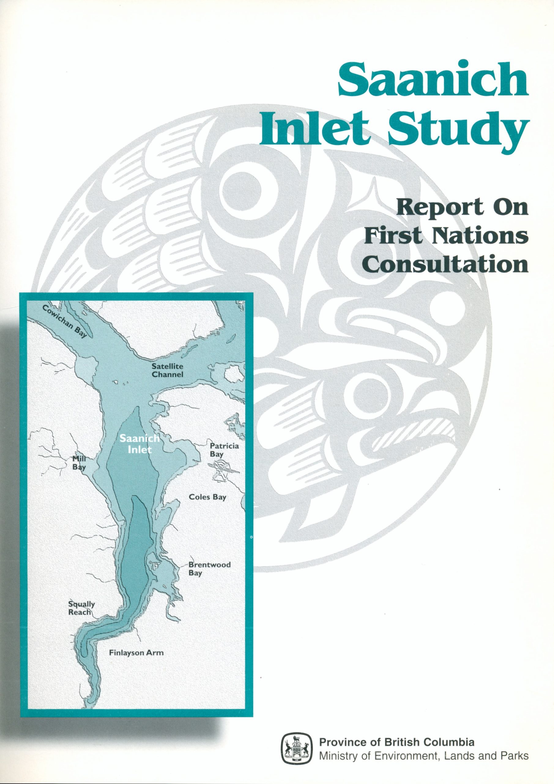
[Artwork: Coast Salish Design, “Thunderbird and Salmon”, by Roddy Albert Modeste, Sr., Malahat. In a waveform-style circular design, Thunderbird flies eastward with Salmon in its talons. The design’s lower right quarter is hidden behind the map.]
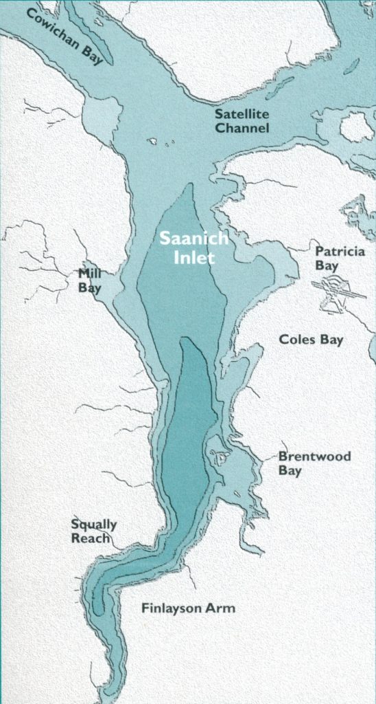
[Map: In a bold-outlined box at bottom left, a map of Saanich Inlet with bathymetry (depth) outlines, highlighting how the Inlet deepens south of Satellite Channel. Clockwise from north on the Saanich Peninsula, the map is labelled Patricia Bay, Coles Bay, Brentwood Bay, Finlayson Arm, Squally Reach, Mill Bay, with Saanich Inlet over the water. Cowichan Bay and Satellite Channel are labelled to the northwest and northeast.]
[Logo:]
Province of British Columbia Ministry of Environment, Lands and Parks
[Pencil marking at top centre: E78 (cropped) B9S55]
Cover Design: Domo Communications Management
Saanich Inlet Study reports available from:
Coast Salish Design: “Thunderbird and Salmon” Roddy Albert Modeste Sr. Malahat Indian Band
Ministry of Environment, Lands and Parks Water Quality Branch Third Floor, 765 Broughton Street Victoria, BC V8V 1X4 Tel.: (604) 387-9500 Fax: (604) 356-8298
Canadian Cataloguing in Publication Data
Simonsen, Bjorn O., 1940–
Saanich Inlet study. Report on First Nations consultation
Includes bibliographical references: p. ISBN 0-7726-2581-6
Saanich Inlet Region (B.C.) – Antiquities
Indians of North America – British Columbia – Saanich Inlet Region – Antiquities.
Land use, Rural – British Columbia – Saanich Inlet Region.
Thanks are extended to the many people who assisted in this project and made it possible, including:
Tseycum
Chief Vern Jacks, Tillie Jacks, Gabe Jack, Joseph Bill, and Lydia Pelke.
Tsartlip
Tom Sampson, Fraser Smith, Simon Smith, Sammy Sam, Kevin Paul, Gabe Bartleman, Adelynne Claxton, Philomena James, Ivan Morris, John Sampson, Derek Sampson, and Deanna Daniels.
Pauquachin
Chief Elmer Henry, Diana Henry, and Herman Henry. Also, thanks to Pauquachin for the use of their recreation centre on February 15, 1995.
Tsawout
Harvey Underwood, Earl Claxton Jr., Cecelia Thomas, and Gus Underwood.
Malahat
Chief Rod Modeste and Robert Harry.
Cowichan
Wes Modeste and Eamen Gaunt.
First Nations of South Island Tribal Council
Chief Cyril Livingstone.
Others
Laurie Acheson, Jason Austin, Randy Bouchard, Alan Calder, Ray Crook, Jimmy Gilbert, Martyn Glassman, Don Howes, Ingrid James, Ben Kangasniemi, Grant Keddie, Dario Stucchi, and Dr. Nancy Turner.
Saanich Inlet Study Report on First Nations Consultation
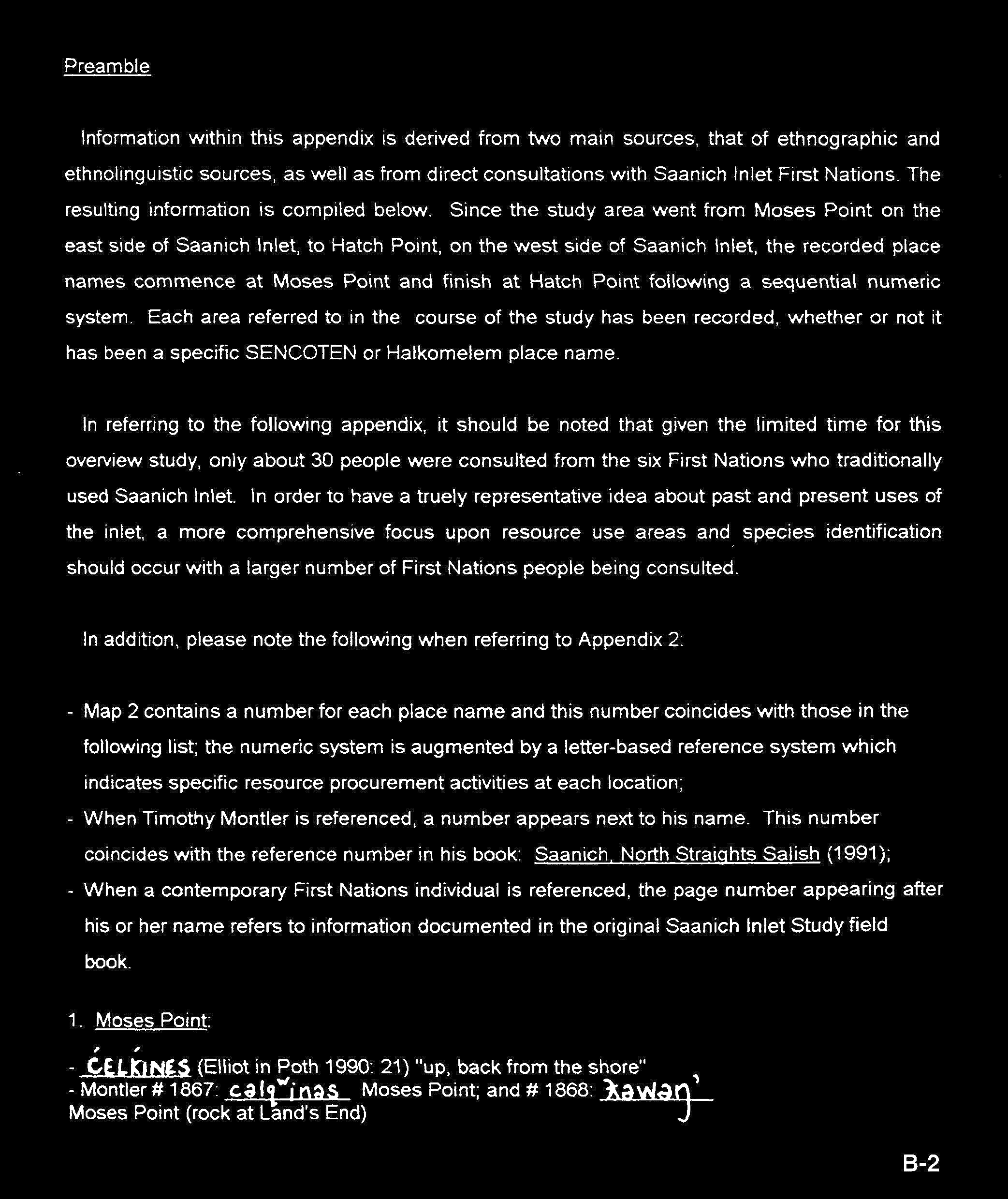
Information within this appendix is derived from two main sources, that of ethnographic and ethnolinguistic sources, as well as from direct consultations with Saanich Inlet First Nations. The resulting information is compiled below. Since the study area went from Moses Point on the east side of Saanich Inlet, to Hatch Point, on the west side of Saanich Inlet, the recorded place names commence at Moses Point and finish at Hatch Point following a sequential numeric system. Each area referred to in the course of the study has been recorded, whether or not it has been a specific SENĆOŦEN or Halkomelem place name.
In referring to the following appendix, it should be noted that given the limited time for this overview study, only about 30 people were consulted from the six First Nations who traditionally used Saanich Inlet. In order to have a truely representative idea about past and present uses of the inlet, a more comprehensive focus upon resource use areas and species identification should occur with a larger number of First Nations people being consulted.
In addition, please note the following when referring to Appendix B:
Map 2 contains a number for each place name and this number coincides with those in the following list; the numeric system is augmented by a letter-based reference system which indicates specific resource procurement activities at each location;
When Timothy Montler is referenced, a number appears next to his name. This number coincides with the reference number in his book: Saanich, North Straights Salish (1991);
When a contemporary First Nations individual is referenced, the page number appearing after his or her name refers to information documented in the original Saanich Inlet Study field book.
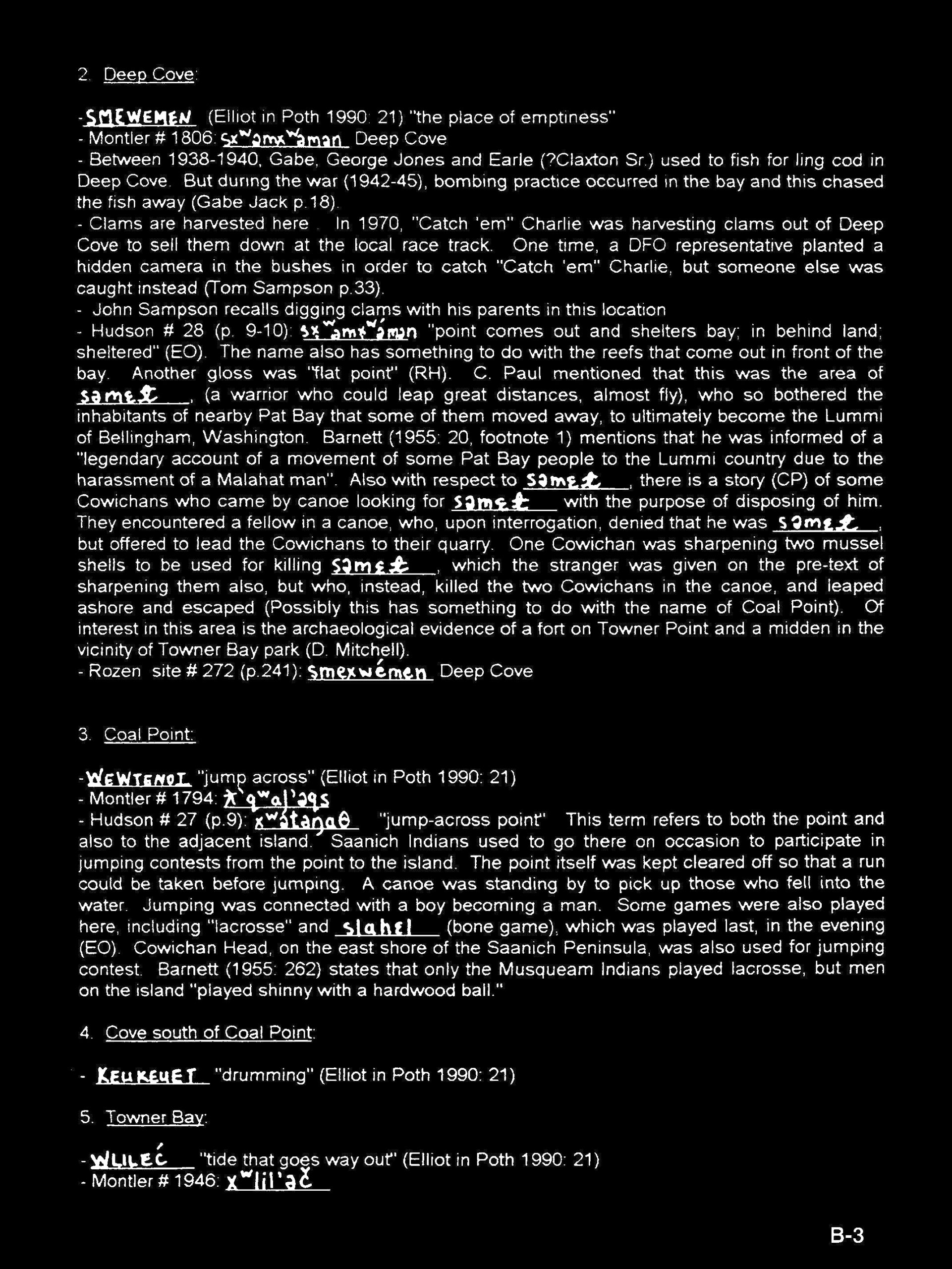
Between 1938-1940, Gabe, George Jones and Earle (?Claxton Sr.) used to fish for ling cod in Deep Cove. But during the war (1942-45), bombing practice occurred in the bay and this chased the fish away
Gabe Jack p. 18
Clams are harvested here. In 1970, “Catch ’em” Charlie was harvesting clams out of Deep Cove to sell them down at the local race track. One time, a DFO representative planted a hidden camera in the bushes in order to catch “Catch ’em” Charlie, but someone else was caught instead
Tom Sampson p. 33
John Sampson recalls digging clams with his parents in this location
John Sampson
“point comes out and shelters bay; in behind land; sheltered” The name also has something to do with the reefs that come out in front of the bay
EO
Another gloss was “flat point”
RH
C. Paul mentioned that this was the area of səmɛɬ [SEMAȽ] (a warrior who could leap great distances, almost fly), who so bothered the inhabitants of nearby Pat Bay that some of them moved away, to ultimately become the Lummi of Bellingham, Washington.
C. Paul
Barnett mentions that he was informed of a “legendary account of a movement of some Pat Bay people to the Lummi country due to the harassment of a Malahat man”.
Barnett (1955: 20, footnote 1)
Also with respect to (səmɛɬ) SEMAȽ, there is a story of some Cowichans who came by canoe looking for SEMAȽ, with the purpose of disposing of him. They encountered a fellow in a canoe, who, upon interrogation, denied that he was SEMAȽ, but offered to lead the Cowichans to their quarry. One Cowichan was sharpening two mussel shells to be used for killing SEMAȽ, which the stranger was given on the pre-text of sharpening them also, but who, instead, killed the two Cowichans in the canoe, and leaped ashore and escaped (Possibly this has something to do with the name of Coal Point).
CP
Of interest in this area is the archaeological evidence of a fort on Towner Point and a midden in the vicinity of Towner Bay park
D. Mitchell
3. Coal Point:
Name
Details
Source
W̱EWTENOṮ
“jump across”
Elliot in Poth 1990: 21
ƛʼqʷalʼəqs
Factso note: this is a different Coal Point, on Orcas I, WA.
“jump across point” This term refers to both the point and also to the adjacent island.
Hudson #27 (p. 9) (EO)
Knowledge
Source
Saanich Indians used to go there on occasion to participate in jumping contests from the point to the island. The point itself was kept cleared off so that a run could be taken before jumping. A canoe was standing by to pick up those who fell into the water. Jumping was connected with a boy becoming a man. Some games were also played here, including “lacrosse” and slahɛl (bone game), which was played last, in the evening. Cowichan Head, on the east shore of the Saanich Peninsula, was also used for jumping contest.
EO
Barnett states that only the Musqueam Indians played lacrosse, but men on the island “played shinny with a hardwood ball.”
Gabe Jacks’ father took 17 sacks of oysters from around Cowichan and nurtured them here to harvest a little closer to home. These oysters thrived and it was a well known place to harvest oysters until one day he was kicked off the foreshore because its status had changed to private property due to a foreshore lease with a private marina. Tom Sampson also recalls this event.
Gabe Jacks (p.22); Tom Sampson
Izadore Harry and Simon Smith’s uncle, Willie Smith, would harvest whatever they could for subsistence from the Saanich Inlet: “…whatever they could live off from the bay.” With regard to harvesting clams, Mr. Smith asserts that one way to keep a beach clean and healthy is to dig it all the time in order to “keep the beach from dying.” For example, in Towner Bay due to harvesting restrictions, the Saanich cannot dig here and this beach has become smelly. Clams rot en masse and the ground becomes contaminated.
“Union Bay Reserve”, “Tsekum”, “Tsehum”, ‘clay place’
Rozen #271 (p.241) (ADF; AF; CP)
xʷséˀq(ˡ)əm
“Union Bay Reserve”, “bay with flat land behind”, “almost connected”, to Tseycum Harbour.
Hudson #26 (p.8) (RH)
smɪsélə (smiselu)
The creek on the northern boundary of the reserve is smiselu “hidden creek”
RH
Knowledge
Source
Two years ago [in 1993], herring were spawning. This has not occurred for a very long time according to all Saanich people interviewed. When Sammy Sam was young, he would hear his grandmother, Julie Smith, yell “slonghet” when the herring came into the bay to spawn. When people heard this announcement, everyone got busy. Cedar branches would be laid on the beach and the spawn would be placed on the boughs to transport back to people’s homes. People also raked the fish for food.
Sammy Sam
Beach used for harvesting shellfish
pers. observation Bjorn Simonsen
Emphasis is on two aspects — the ‘almost’ interconnectedness, and the clay composition of the area, as we have: xʷséqʼəm, “clay and” (EO), and “all clay land” (CP).
EO; CP; RH
Suttles provides some ethnographic background for the habitation, stating: “The village stood on the northeast shore of the bay. Jenness says that this village moved here in the nineteenth century form a place near Sidney to avoid the raids of the Northern Indians. The village near Sidney was called ‘saiklam’, meaning ‘clay, he says, and when the people moved, the name came with them.” However, Suttles writes that he didn’t get information concerning a movement around the peninsula, although such movements are evident in the first half of the nineteeth century. At any rate, there were, in the early 1890’s, four old-style ‘big houses’ present.
There used to be salmon spawning in this stream. However, due to run-off from farm fields and housing developments, the stream is both polluted and fluctuates seasonally. In 1977, Tseycum village attempted to rehabilitate local salmon spawing tributaries by dredging the gravel, but fisheries said that there was no use to do this since these streams were also polluted by run-off coming down from farmer’s fields. Now [1995] there is no clam digging, and no salmon in the stream
Dog salmon used to spawn in this creek; however, for the above reasons, this creek is now defunct
Tom Sampson p.33
9. Spring at Patricia Bay Slough:
Name
Details
Source
TḴ'AYEĆ
“small closed off area”
Elliot in Poth 1990: 21
10. Patricia Bay Slough:
Name
Details
Source
TELÁW̱EṈ
“small closed off area”
Elliot in Poth 1990: 21
11. Creek at Ocean Science Research Institute:
Name
Details
Source
T̸EṈTEN
“bailer” in Cowichan
Elliot in Poth 1990: 21
12. Beach south of Ocean Science Research Institute:
Knowledge
Source
This is a good area for butter clam digging
John Sampson; Vern Jacks; Gabe Jack
13. Dyer Rocks:
Name
Details
Source
S,LEḰTÁN
the late Norm William’s father’s name
Elliot in Poth 1990: 22; Ivan Morris
squinheləˀ (sqinhelu’)
“sea gull”
Hudson #25 (p.8) (LP)
Knowledge
Source
Grave site
Ivan Morris
Dyer rocks was perfect gathering grounds with about a 2 knot tide. It is a unique ecosystem and hosts sea lions, water birds, and edible seaweed which was harvested from here
Jim Gilbert p.34; Tom Sampson
Brown seaweed, edible seaweed in its second phase, is gathered here in March
“Pauquachin” (exact meaning not known, perhaps ‘shallow, sandy’)
Rozen #270 (p.24) (ADJ; AJ; CP)
pʼəʼkʷəčən
Hudson #24, (p.8) (CP; RH)
p̓kʼʷəčən
“shallow” (refers to the sand bar – p̓kʼʷəčən, sand, sand bar)
M. Mitchell 1968
Knowledge
Source
Fishes have disappeared from Cole Bay. Elmer would fish when he was young and hunt grouse, now [1995] he can’t do either anymore. He can no longer go onto the beach to dig clams in Cole Bay anymore. “These days you have to go to Safeway for your food” clams harvested here
Elmer Henry
Cole Bay is a seaweed harvesting area. From March to May, seaweed was gathered when the tide line is low. Now [1995], there is not much seaweed around
Elmer Henry; Tom Sampson p.21
Jimmy Gilbert still [1995] harvests clams from Cole Bay when he is hungry. Both clams and oysters were harvested from this area. Jimmy also recalls Henry’s (?Henry James) family gill netting along the shoreline at Cole Bay shorelines fished
Jimmy Gilbert p.31
Herring used to be raked here
Sammy Sam
Clams harvested from Cole Bay all along the shoreline to Brentwood Bay
Tom Sampson and John Sampson
John remembers these shores being lit-up by gas lights when he was younger.
John Sampson
Rock cod fishing with a spear occurred at Tod Inlet, the other side of Hagan Creek, Thomson Bay and at the south end of Coles Bay
[Continued:] 14. Coles Bay: Pauquachin Indian Reserve
Knowledge
Source
[any shallow] spot is called pʼəqʷəɬəč… Mention was also made of the steep bluff across the front of the reserve situated at Cole Bay, the term then apparently applying to both a shallows, then a high rise (ridge) behind.
E. Olsen
One form also, was pʼə̉kʷətsən, “people of the shallow spot”, where sən is glossed as “people”.
RH
Little information is evident for this place, although there was a village by the creek in the northwest sector.
Mt. Newton itself is – “refuge mountain”, but the term seems to cover the area extending from one side of the peninsula to the other.
Hudson #23 (p.7-8) (CP)
sɬəkéyˀyə
“wolf cave” [near lake in centre]
RH in Hudson
sxʷukəθəwtxʷ
cave of the thunderbird [west slope]
RH in Hudson
Knowledge
Source
These are ceremonial grounds where Saanich people go to gain strength and pray.
Ivan Morris p.3
There used to be a little stream in what is now known as Dean Park and this would be used for ritual bathing. Now it dries up for part of the year which it never used to do. Some of the old people used to collect this water for their drinking water.
Simon Smith p.37
There was one place on a mountain to the north of Saanich which was a good spot to look for power. Tommy Paul’s Grandfather had often told him about it. It was near a lake, at the foot of a bluff inwhich there was a cave where the thunderbeird lived. If a “clean” (unmarried) man went there, he could see the coils of cedar-limb ropes used by people to anchor their canoes at the time of the mythical flood. On the plateau above the bluffs were to be seen radial alignments of rocks made by previous seekers for the deposition of their scrubbing bundles which they brought from the lake below
Tommy Paul in Barnett 1955: 152
…a place where one seeks spirit power, as well as the home of the thunderbird. The slopes were used as a refuge from attacks from northern Indians (from ɬelxʷəl, “to run away from danger”; nəxʷ, “land – where you stop”).
Hudson #23, (p.7-8) (CP)
Also, in the flood stories, Mt. Newton was one of the mountains that was not submerged, and there refuge was taken.
Hudson
Another story is that, upon the mountain, in the centre, is a little lake of unknown depth, with a coil of rope beside it. Nearby is the cave of the wolf. On the west slope is the cave of the thunderbird.
RH
Jenness mentions that there existed a pond on top, surrounded by a circle of stones, up to which one would go to acquire a guardian-spirit power. Ritual purification was effected by bathing in the pond, and placing yew bundles under all the stones of the circle.
Jenness p.80 in Hudson
(Barnett’s account already documented above).
Barnett in Hudson
16. Small Cove North of Thomson Cove:
Knowledge
Source
This is a spot where canoe racers used to mark the race’s start or finish line
Tom Sampson
17. Thomson Cove:
Name
Details
Source
čačqʷinič
“long way to back”, “deep” (ie. far back bay)
Hudson #20, (p.6) (EO)
Knowledge
Source
This cove is a fishing spot for spring salmon, cohoes, and cod
Grave island. When Ivan was a young boy, he remembers the older people telling him and other children out of respect for the island graves, not to put their canoes up on small islands within the inlet. These graves consisted of canoes which were placed on the islands.
Grave island. When the Mill Bay ferry started to sail [Nov 1924], a directional flag was erected on the island and Ivan expressed his dismay regarding this insensitive measure
Ivan Morris p.3
Clam harvesting beach; [1995] still used these days
Simon Smith; pers. ob Bjorn Simonsen
Seaweed collected in its second phase off Senanus Island’s shores
Sammy Sam p.50
It is interesting to note the anatomical referencing of the island, the base being ɪ́nəs, “chest”.
“place of broadleaf maple trees” (Note that this alternate form is also used to refer to the residents of the Tsartlip Reserve today)
(AJ; CP) in Rozen
xʷč́ə̉ɬəɬp (hwch’ulhulhp)
The present sitde of this large Indian village is hwch’ulhulhp, which has been Anglicized to Tsartlip – the home of the West Saanich… Indians. It appears from ethnographical data that the area has had inhabitants for some time.
Hudson #15 (p.5) (EO)
Knowledge
Source
“Brentwood Bay is really dead now. There used to be herring and smelt. I remember people using a rake to catch smelt and people would know when it was time to fish because of the sea gulls. Up until [1985/6] nine or ten years ago, you would look out and sea gulls created a white cloud over the inlet there were so many of them. …Mers (Merganser), used to be able to walk out in the evening and hear their songs – the water would be alive. Little black ducks (coots ?) would also be numerous, and now there are only a few. “Long-necked hell divers” (cormorants) – now the only time you see them is in the fall when Chum salmon are in the inlet, but they used to come here all the time.” In regards to native oysters, there used to be lots of these in the bay; however, not any more. This is most likely due to PCB and red tide closures. This also applies to clams, and there is only a three month harvesting span for clams now, versus traditional year-round harvesting. Children are not encouraged to swim in the bay due to water pollution. Before these problems, youths partaking in initiation ceremonies would swim in these waters early each morning.
Simon Smith pp.37-43; this above testimony has also been mentioned by many other people interviewed from Tsartlip, namely: Fraser Smith; Sammy Sam; Tom Sampson; Gabe Bartleman
Cod spearing area; camping and village site; clam and mussel harvesting. Mussels used to be abundant in front of the village, and now there is nothing
Tom Sampson p.29
Basking sharks used to be in the inlet. One shark used to lounge around the shoreline near Ivan Morris’ house probably because of the warm, shallow water and the plankton
T. Sampson and J. Gilbert
Long-line fishing conducted at night. Tommy Paul long-lined and used dogfish for garden fertilizer since everything was used, nothing was wasted
Simon Smith p.43
Jenness mentions that the old village (contiguous to Hagan’s Creek) was destroyed about 1850 by Comox or Kwakiuti Indians on a [raid while all of the inhabitants were away fishing in Saanich Inlet near malahat.]
[Continued:] 21. Brentwood Bay: (Tsartlip Indian Reserve #1)
Knowledge
Source
From Barnett, there is some information regarding the village layout (post 1850) – seven big houses (long houses), six of which were “lined up parallel to the beach and were separated by small creeks”, the seventh being behind the others.
Barnett (1955: 19) in Hudson
Barnett also provides information about an origin story of the Tsartlip people (migration from East Saanich ?): “Kwoclakwinθat was said to be the forefather of all the tcalxp (Tsartlip) people. A lazy boy, he had finally been shamed into getting supernatural power. He moved to totcalep because it was safer from war attacks, and founded a village. The former inhabitants were all dead by the time of his arrival” (Barnett was unable to obtain any information about the ‘former inhabitants’).
Barnett (1955: 20) in Hudson
Apart from the above history of Tsartlip, Jenness also documents the “economic cycle” of this community at this historical time period. Since the description lacks any particular resource harvesting place names and is fairly lengthy, the reader should refer to the source for further details.
Jenness (1938: 7-8)
mentioned above in Hudson’s work
Barnett p.19-20
22. Creek at south end of Tsartlip by the boat ramp:
a whale beached itself here (mouth of the creek) once
Elliot in Poth 1990: 22
The only area Jimmy Gilbert and Tom Sampson are aware contains remnants of a stone fish weir
Jimmy Gilbert p.29
Canoe logs harvested from here. When Henry (? James) was a boy, he used to go up there with canoe builders and rough out the logs and wait until winter time to slide these huge dug-outs down to the water
J. Gilbert p.30
Chum and spring salmon spawn here
T. Sampson p.33
This is a trout stream which Simon has fished since childhood
S. Smith p.42
24. Hagan Beach:
Name
Details
Source
TITECEN
from title “highly valued” and cen “belonging to, to receive” refers to something of spiritual significance
also an area where graves erected as platforms above the ground
Elliot in Poth 1990: 23
A line from Sluggett Point to the S.E. shore below Willis Point, is where ice forms due to lacking water currents. During this time, waterfowl would gather in the water in front of the ice-line probably for purposes of shelter provided from Willis and Sluggett Points and the inaccessibility into Tod Inlet. This was a good waterfowl hunting area in the winter when fresh foods were less available.
Simon Smith; Fraser Smith
29. Daphne Island:
Name
Details
Source
č_tnəxᶱćləˀ (chiitnuhwelu’)
“hoot owl island”, “home of the hoot owl”
Hudson #14, (p.5) (EO)
Knowledge
Source
Grave island
T. Sampson; I. Morris; Elliot in Poth 1990: 67
[the Denny family have the collection from this site]
J. Gilbert p.30
30. Daphne Point:
Knowledge
Source
Clams harvested from here up to Hagan Bight
S. Smith p.37
31. Small Bay SE of Daphne Island and NE of Tod Inlet:
Clams harvested all along the rocky shores of the inlet
Simon Smith; Frazer Smith; John Sampson; Philomena James
Spring salmon fished during the late winter when herring enter (entered) the inlet to spawn in the eelgrass
Simon Smith; Fraser Smith; Tom Sampson
ling cod
T. Sampson
Jimmy Gilbert recalls seeing at least 17 Saanich fishing canoes and row boats in Tod Inlet one evening
Jimmy Gilbert (p.31)
Tommy Paul used to fish this area with gill nets (Jim has a few of his wooden floats). The area was used for trolling salmon during the herring spawn. Ling cod is also fished from the inlet. Tod Inlet used to be the best clam (little-neck) harvesting area in Saanich Inlet.
Tommy Paul
Bull rush collected in Tod Inlet. Sammy remembers women gathering plants and rush in a marshy area at the head of the inlet. When the rock quarry started blasting rock [in 1904], dust covered a substantial amout of medicinal plants in certain areas within the Saanich Peninsula
Sammy Sam p.49
Within Tod Inlet, there are two little tributaries, one has a cove. Ritual bathing occurs within these creeks. Simon knows of at least 10 people who continue ritual bathing activities
S. Smith p.37
Canoe pull-outs occur along the NW shoreline used as an access point to hunt within the Gowlland Range. John Sampson also used to see lots of trollers fishing in the inlet with his brother, Chuck Sampson.
“like a body of water pointing in like a finger, going way up in land”
Hudson #13 (p.4-5) (EO)
sngi’qwulh
“inlet”
Hudson #13 (p.4-5) (CP)
33. Tod Creek:
Knowledge
Source
Cut-throat trout fished in Tod Creek
Jimmy Gilbert p.31
Clams, herring, trout, salmon in streams
Tom Sampson; Fraser Smith; Simon Smith
used to fish for rainbow trout here and sold perch to a Chinese man in trade for vegetables and potatoes
John Sampson
34. Willis Point:
Name
Details
Source
sxʷáxʷiˀəm (shwahwi’um)
“divides inlets up” The name above refers to the bifurcation (splitting) of Saanich Inlet into Tod Inlet and Squally Reach due to the headland behind Willis Point.
Hudson #12, (p.4) (EO)
35. Gowlland Range area::
Knowledge
Source
This entire area is used for deer hunting
Ivan Morris; Tom Sampson; John Sampson; Simon Smith; Fraser Smith
Before the region became more populated, elk used to roam here as well as wolves, and Mtn. goat.
Fraser Smith
Cod spearing occurs all along this shoreline. Simon Smith also spoke of a powerful force that came from the Gowlland Range.
Simon Smith
Ceremonial grounds on the east side of the Gowlland Range. When Tom was young, he was forbidden to wander into this area due to its powers.
T. Sampson, p.31
36. McKenzie Bight:
Name
Details
Source
WMÍYEŦEṈ
“place of deer”
Elliot in Poth 1990: 21
xʷmóyəθin (hwmoyuthi)
“land of deer” From “deer” smáyəθ (smayuth) This refers to the general area of what is called MacKenzie Bay, terminologically extending perhaps to Durance Lake.
Hudson #9, (p.4)
Knowledge
Source
Clams harvested between here and Willis Pt.
Philomena James
Evidence of shell middens along this shoreline
pers. ob. Bjorn Simonsen
This beach is known as “deer beach”. Tom Sampson mentioned that intentional landscape burning occurred here, probably in order to invigorate certain food plants (ie. berries; camas), and this may be why deer were very attracted to this certain area. Tom Sampson’s great grandfather would use dogs to chase deer into the water.
Tom Sampson (p.32)
Jimmy Gilbert asserts that burning may have occurred in order to inhibit (?) the Douglas fir and promote salal, huckleberries and other food plants.
Jimmy Gilbert (p.32)
Within Simon Smith’s extended family, there are probably around 120 people, and out of this, only three are designated (?hereditary) hunters. There is good deer hunting in McKenzie Bay; however, due to human encroachment, for two main reasons, it is very difficult to hunt: first, because of increased housing developments, wildlife are moving further out to the Malahat Range, and there are less deer in the Gowlland Range. This first deterent signifies both extra money spent on travelling longer distances, as well as more time required for hunting (which is an indirect expense). The second problem is that of a value clash between Saanich members who chose to hunt for a portion of their sustenance, and outdoors enthusiasts, who would most likely be offended to witness a deer being hunted.
The term refers to the long bay on the west shore, a camping ground and clam-digging locale.
CP
39. Pease Creek:
Knowledge
Source
mentioned that this area has been used by the Saanich
Grant Keddie (RCBM)
Dog and coho salmon fished here
J. Gilbert p.32; Tom Sampson
40. Elbow Point:
Name
Details
Source
qʼʷáčəməs (qw’achumus)
“bare forehead”
Hudson #6, (p.4) (EO)
Knowledge
Source
Cod, salmon and octopus harvested from this area
S. Smith
Deer hunting takes place from around here to Goldstream
T. Sampson
Behind here is the approximate vicinity where a fence was erected to hold livestock when the Saanich were away on fishing, hunting and plant gathering excursions
T. Sampson, p.31
41. Sawluctus Island:
Name
Details
Source
TQEȽNEȽ
Elliot in Poth 1990: p.24
pə̉nɬnəɬ (punlhnulh)
The native term for Goldstream and vicinity seems to have fixed upon the island in the lower Saanich inlet… But the Saanich terms seems to have been: punlhnulh, “to smoulder or smother”, in reference to smouldering wood in a stone pot.
Hudson #3 (p.2) (EO)
Knowledge
Source
Cod and salmon fished around the island
S. Smith p.38
Humpback whales used to swim all the way down here and attempt to rub the barnacles off of themselves along the island’s shoreline
G. Jack p.18
A smoldering piece of special moss was kept alive in a bound horse clam shell so that when families went past to fish, they would stop here, unbury this shell, blow on it, and attain fire. Families were communaly responsible to maintain this fire
J. Gilbert; T. Sampson, p.32
from which a duck net was once stretched to the east shore of the inlet (raised duck net is tə̉qem (tuqum)
CP in Hudson
During the fishing season at Goldstream, the first family to go from hwch’ulhulhp would take smouldering bark (from cherry tree?) in a stone pot and leave it on the island, where, subsequently, each family passing through to Goldstream would obtain fire from this source.
Hudson
A substantial shell midden is evident here also; Shell midden also spotted during boat tour of the Saanich Inlet.
D. Mitchell (1970: per. comm.); pers. ob. Bjorn Simonsen
42. Goldstream:
Name
Details
Source
_ELE₭TEL
Elliot in Poth 1990: 24
Knowledge
Source
Crabs harvested here
S. Smith
Goldstream is the only area where you can harvest dungeness crab, which prior to 1975, was not a known species to occur in this area
J. Gilbert p.33
Canoe logs were extracted from Goldstream as well as logs for building
J. Gilbert p.30
Mr. Sam states that people were able to derive two canoes out of the butt-end of the enormous cedars in Goldstream.
Sammy Sam, p.48
Ed Thomas’ father retrieved canoe logs from Goldstream.
A trail used to exist that went from Goldstream to Heals Rifle Range. The trail was named (sounds like) scolutum, which means “things that hang from trees” – lichen.
G. Jack p.23
xʷcéƛʼəḿəɬp xwtsátl’eḿehlp
“jump tree or bush” None of the Island Halkomelem people consulted during this study recognized this term for Goldstream, a fishing and camping site of the Saanich (and Malahat and Cowichan).
Leslie 1979: 76, in Rozen
s7éiekwʼtelh
AJ and CP, both fluent speakers of Saanich (Straits Salish), recognized this place-name by its Saanich form s7éiekwʼtelh
Rozen #257 (p.237) (AJ and CP)
səwʼlə̉wtəs (suw’luwtus)
As in so many names, the classification is referenced to an area, rather than a specific point, so that there seem to be different interpretations of the same phenomena. The following meanings were obtained for the above: “valley stream”, “always a foggy stream”, and “deep valley”;
Hudson #2 (p.1) (RH)
səwʼlə̉wtəs (suw’luwtus)
“our fishing ground tucked inside arm”. Goldstream was traditionally… (already quoted in Rozen’s above work)
Hudson #2 (p.1) (EO)
Knowledge
Source
Clam harvesting here. This was the most important harvesting location for the old group
Philomena James
Malahat had a smokehouse and an orchard where the Nature House is now located
T. Sampson, p.32
Ritual bathing in small streams entering into Goldstream estuary
Simon Smith p.37
There is a contemporary Native-run salmon enhancement and fishery business located at Goldstream. This business [founded ~1985] is about 10 years old, and began with about 2,500 chum salmon in Goldstream. Surplus fishing was halted, and a stream rehabilitation and maintenance program set-up. Now [in 1995] there are up to 80–100,000 chum salmon that spawn in Goldstream
Simon Smith p.39-40
The mouth of Goldstream is a good plant gathering grounds
Sammy Sam p.49
Traditional berry picking area
Vern Jacks
Saanich smokehouse at SE side of Goldstream estuary
T. Sampson
Hudson recorded some aberrant information concerning Goldstream from one of his Saanich collaborators at Saanichton Bay. At least some Saanich people believed that Goldstream was “traditionally important as a salmon stream… The vicinity in question was once owned by Cowichan Indians, and later by the Saanich.” CP was adamant that the Goldstream area was utilized almost exclusively by the Saanich of Brentwood Bay until the early historic period, when there were so few salmon there that the Indians did not use it anymore. As a compensation, the Department of Indian Affairs now (in 1985) gives the Indians at Brentwood Bay salmon from elsewhere because fishing at Goldstream is now forbidden.
Hudson (1971:2 (?1970)) (CP)
AJ felt that the name Leslie recorded (xwtsátl’eḿehlp ‘jumping tree place’) did not refer to an actual botanical species with the name tsátl’eḿehlp.
AJ in Rozen
Chum or dog salmon were gaffed here
Claxton and Elliot 1994: 52
The Tsartlip would catch dog salmon at Goldstream in late September
Jenness 1938: 7
43. Mount Finlayson
Knowledge
Source
Back of this area used to harvest berries
T. Sampson
44. Christmas Point area
Name
Details
Source
WKOŦEȽP
“bow and arrow plant”, yew tree in Cowichan
Elliot in Poth p.24
qʷə̉ləθp
qwuluthp
Hudson #4, (p.2) (EO, CP)
Knowledge
Source
From Christmas Point to Goldstream lots of clam digging, especially at Misery Bay
Philomena James
From Christmas Point along the hillside where new [1995] development is occurring, we observed quite a few instances of soil erosion where new roads are being developed. These small landslides have caused heavy siltation to occur during heavy rainfall, causing many Saanich residents to comment on the inlet’s turbidity.
This term is the name of a little bush (“something like yew wood”) with slow burning wood, that grows there (?hairy manzanita)
Place where the Saanich go for rest and relaxation and also gain strength
T. Sampson
Kayakers pose a problem. One time Tom Sampson was deer hunting here (nr. stone steps at N. end of tributary), but there were kayakers here enjoying the scenery, so Tom witheld from shooting his potential game.
Tributary contains eelgrass that crabs like and the latter were harvested from here
T. Sampson
52. Johns Creek:
Knowledge
Source
Trout fishing
J. Gilbert
Ritual bathing
S. Smith p.37
Estuary area all the way up to Mill Bay was formerlly a good clam harvesting location. Now [1995] these clams are inedible.
R. Modeste
Also, crabs were formerlly harvested from the mouth of John’s Creek.
R. Modeste
53. McPhail Point:
Knowledge
Source
This used to be a herring spawning area. Rod remembers this as a child since there was a Potlatch and Rod ventured down to the beach with a bag and collected a nice share of herring roe. When he brought it back to the gathering, his mother asked him where he collected this and he told her at McPhail Point. Rod was requested to go back and fetch herring roe numerous times during the gathering to share with the guests, making it a memorable time during his childhood.
R. Modeste
Rod also mentions that clams used to be gathered from McPhail Point; however, they are now [1995] contaminated and have a gelatinous consistency. He believes that this is due to impacts upon the environment by the Brentwood – Mill Bay ferry service, since it is perceived that raw sewage is dumped into the inlet.
There seems to be a generic term for the area of the west bank of the Saanich Inlet, mumuxe’lh “caterpillars”, which refers to a caterpillar plague that occurred at the time that government crews were naming the area (date unknown).
Hudson #5, (p.2-3) (CP)
ya•s (yaas)
Malahat Mtn. itself was refered to as yaas
Hudson #5, (p.2-3) (CP)
Knowledge
Source
Plant harvesting on this range
Vern Jack’s mother p.2
Malahat Range used as a camping area
S. Smith p.37
This area contains grave sites, since certain people who are known to have power that have passed away are buried far away from the village
R. Modeste
The meaning is unknown, but ya•s was the home of the legendary rainmaker, sinəɬkey, a four-legged serpent-like creature. To bring rain, one had only to point at ya•s. But sinəɬkey left the area because of the encroaching pressures of an industrial society.
CP
As an interesting note, one story told me was that the thunder over Saanich Inlet was the result of the fights between the thunderbird and sinəɬkey (sinulhkey).
Hudson
In a later passage, Barnett again makes note of the above: “The double-headed serpent (sinalke) lived in lakes and gave ritually unclean bathers rheumatism; those who drank the water of lakes inhabited by it bled at the mouth.”
Barnett (1955: 153)
Apparently, the power of the sinəɬkey was obtainable by humans as a doctor’s spirit, as Barnett mentions that Tommy Paul’s uncle obtained possession of this power.
alternate pronounciation; this term is the same in Halkomelem and Straits
AJD; AJ; AT; CP
Mā̄ʼlegatl
Boas 1981: 76
məməx̣ɛɬ
‘caterpillars’
Hudson 1971: 2
mumuxelh
Hudson 1971: 2
méʔlᴧxᴧᴛ
Mitchell 1968: 62
maláhat
Barnett 1955: 19
Mâ̂lǔhǔt
Barnett, field notes
Malakut
Jenness n.d.: field notes
Mǎ̇́ʼlǔhuhl
Curtis 1913: 37
Málechatl
Boas 1887: 132
Mala-chult
“Chief was Selp-queinum”
Douglas 1853: 14
Knowledge
Source
Jenness mentions that, on ya•s, ther are a poned and a stone circle, corresponding to one on Mt. Newton, used in ritual purification during a spirit quest.
Jenness (n.d. (?1938): 80)
The Mill bay area formerly had at least two permanent winter villages. The first, ḵéya, was near the head of Mill Bay near the mouth of Shawnigan Creek, skw‘ó7then.
(AJ; Barnett 1955: 19, 141) in Rozen
This village was composed of Indians from the Hatch Point area and from the three villages on the west side of the Saanich Peninsula.
AJ
The second village, máĺex̱elh, became the present-day Malahat Indian Reserve. There were several houses located between Verdier Point and McPhail Point. Apparently, the residents of ḵéya and also some from Hatch Point moved to the Malahat Reserve early in the historic period [1790s-1850s]
Rozen
..estblishment of an Indian Reserve about two hundred thirty-five hectars in area in 1916…
Royal Commission, 1916, Vol. 1: 302 in Rozen
The Mill Bay and Malahat Ridge areas were formerly important to the Cowichan and Saanich. Seals were hunted in the waters of Saanich Inlet east of Mill Bay. Beavers and other land mammals were hunted in the Malahat Ridge and Shawnigan Creek areas.
AJ; CP in Rozen
56. Tozier Rock
Knowledge
Source
ling and rock cod fished around this rock
R. Modeste
57. Sandy Beach
Name
Details
Source
ḰELES
“cooking”, clam-digging area
Elliot in Poth 1990: 25
Knowledge
Source
Crab harvesting area
S. Smith p. 22 & p. 32
58. Mill Bay
Name
Details
Source
o.xʷá.əqʷ (oohwaauqw’)
Mill Bay – Verdier Pt.
Hudson #22, (p.6) (EO, RH)
Knowledge
Source
Clam harvesting area
T. Sampson
According to Jenness, Mill Bay marked the southern extent of the Cowichan Indians in Saanich Inlet.
Jenness (p.1)
At McPhail Point, there was a village site.
Mitchell
Some drag-net fishing was carried out there by the Tsartlip Indians.
Dog and coho salmon fished here. Also trout were commonly fished; however, Rod does not fish in this creek much anymore [1995] since fish stocks have become depleted
R. Modeste
60. Shawnigan Creek
Name
Details
Source
sqʼʷaˀc̦̦̀ən
The creek at Mill Bay (Shawnigan Creek) was called…
Hudson 1970: 6. (M. Pigeon, from C. Paul)
Knowledge
Source
Ritual bathing area
S. Smith p. 37
It is believed that the Malahat formerlly had a village and burial site located at Shawnigan Lake
R. Modeste
61. Hatch Point I.R.
Knowledge
Source
Old village site; clam digging area
J. Gilbert p. 32; T. Sampson; P. James
62. Hatch Point
Name
Details
Source
xʷcɛʔxʷəm (hwceʼhwum)
Rozen # 249, (p.230) Hudson (1970) #29, (p.10) – linguistic place names mentioned above
xwtsá7xwem
Rozen (“in the writing system used in this study”)
Knowledge
Source
Hatch Point formed the boundary between the Island Halkomelem to the north and the Straits Salish to the south. As will be noted later, however, the Indians living at Mill Bay were an amalgamation of people from the Cowichan area and the Saanich Peninsula.
AJ; CP
The term given above, which would be written xwtsá7xwem in the writing system used in this study, is probably the same term that AJ and ADJ have given for Cherry Point. It is obvious that Richard Harry, the Saanich man credited with the term in Hudson, was recalling the location he had heard. But in Hudson the information about the name or term is rather vague. It says that the term is “possibly a Cowichan word…(having) something to do with seashells.” It is possible that the term refers to the area between Cherry Point and Hatch Point or perhaps to all of Boatswain Bank, which likes between the two points of land.
AJ, ADJ, Richard Harry, Hudson 1971: 10
Today [1916] there is an Indian Reserve belonging to the “Saanich Tribe” just south of Hatch Point. It is about thirty-seven hectares in area.
Royal Commission, 1916, Vol.1: 302
63. Saanich Peninsula
The characteristic shape of the Saanich Peninsula (with Mt. Newton the central and prominent feature) is reflected in the terminology:
Name
Details
Source
sǽnič
Saanich
Hudson #1, (p.1)
sænič
“to raise rump in the air”, with reference to the whole peninsula, with Mt. Newton as the rump.
EO
xʷsénič (hwsenich)
Also obtained was the gloss “lifted on top of the water”, and the form hwsenich.
CP gloss; RH form
64. Saanich Inlet
While no term was obtained to cover the inlet itself, direction terms applicable to the inlet were elicited:
Name
Details
Source
táyəl (tayul)
“going in”, “up-river” (south with respect to Saanich Inlet)
Hudson p.1 (EO)
qʷáqʼʷəl (qwaqw’ul)
“going out”, “down-river” (north in the Saanich Inlet)
Hudson p.1 (EO)
Knowledge
Source
Also, mention was made of the sides of the inlet fitting together as a jig-saw puzzle, a concept which may have some significance.
Hudson p.1 (EO)
Fraser used to take his oldest children out on the water to whale watch, now [1995] there are rarely whales in the inlet.
F. Smith p.21
Furthermore, last [1994] summer, Mr. Smith was out fishing in the Saanich Inlet about every second day and he caught no salmon
There used to be anchovies; pilchard and herring in the Saanich Inlet
Waterfowl such as mergansers, Western grebe, cormorants and sea gulls were an important food sources (the first three) as well as environmental indicators relating to weather and the location of fish in the inlet.
J.Gilbert, p.33; S. Smith, p.40; Gabe Bartleman, p. 46
During the [1930s] depression, Gabe and others would fish and trade with local farmers in trade for such items as salt pork and liver. During the 1920’s, a person could go out anytime and catch cod, this no longer occurs.
G. Bartleman p.45-47
There used to be sole in the inlet. The first owner of Brentwood Lodge sold a local “lemon sole” dish, now these sole have disappeared.
G. Bartleman p.45-47
There used to be lots of honeysuckles in Saanich which would bring in hummingbirds and big bees, now these are gone due to housing developments and other forms of encroachment.
G. Bartleman p.45-47
Whales (killer-whales and humpbacks), porpoises, basking sharks, and octopus have all drastically decreased in number
Simon Smith, pp. 42-43
Cod, blue-backs, whales, octopus, waterfowl, raccoons, wolves, elk, plant resources are all cultural resources of the Saanich people and they have all drastically decreased, or disappeared completely
Sammy Sam, pp. 48-51
Seals, porpoises, sea lions and whales are all cultural resources. A Tsawout man hunted whales in Saanich Arm during the 19th Century. So heavy was his harpoon, it was said, that he alone had the strength to wield it.
Jenness 1938: 17-19
Whales could be seen residing in Saanich Inlet, and sometimes, killer whales would chase other whales right up onto the shore where the Saanich would get them
Claxton and Elliot 1994: 51
A mythical single-headed serpent [was] seen under the water at night and a Sanetch man bailed up a scale it had left behind.
Barnett 1955: 53
“I don’t know what it is, but because of the pollution or something, we’re losing our resources. I don’t even see the octopus around much anymore. When we were young, we were told not to hunt unless we were accompanied with an older person. … I used to be able to jig and snag sea cucumbers before, but nothing comes up on my line anymore…”
Simon Smith p. 39
HÍ,SW̱,ḴE SÍAM • Huy tseep q’u
(gratitude, honoured ones, in SENĆOŦEN and hul’q’umi’num’)